Beschreibung
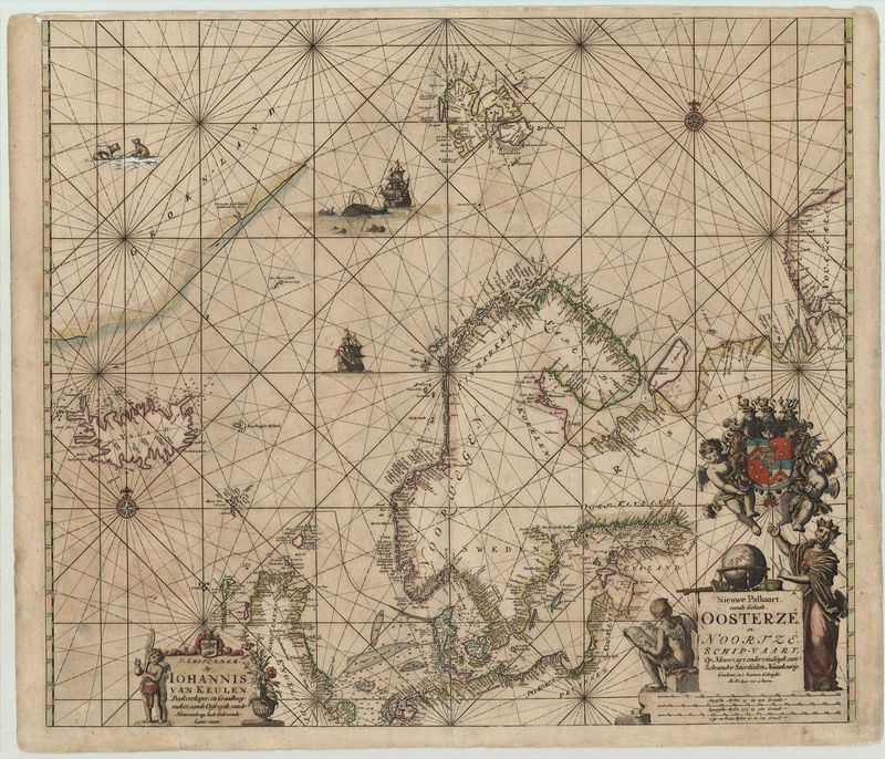
Nieuwe Paskaart, vande Geheele, Oosterize en Noortze Schip-Vaart
Johannes van Keulen
Großartige und seltene Seekarte, auf der die Ostküste von Grönland, Island, Spitzbergen, Nordschottland, Skandinavien und das Baltikum zu sehen sind. Die Küstenlinien und Regionen sind, bis auf Grönland, sehr gut skizziert. Links unten befindet sich eine lieblich ornamentierte Kartusche, die Johannes van Keulen als Hersteller nennt. Rechts unten ziert eine wunderschöne Titelkartusche die Seekarte, sie wird flankiert von einer Frau mit Globus und einem Putto, der einen Atlas liest. Darüber tragen zwei weiter Putten ein Wappen. Auffallend ist die Feinheit und Exaktheit mit welcher van Keulen selbst die kleinsten Details wie die Kompassrosen, die Segelschiffe, die Walfangszene und die Polarbären ausgestaltet hat.
altkolorierter Kupferstich
Bildmaß: 51,3 x 58,7 cm (Höhe x Breite)
A rare sea chart on which you can see the east coast of Greenland, Iceland, Spitsbergen, northern Scotland, Scandinavia and the Baltic States. With the exception of Greenland, the coast lines and regions are very well outlined. The bottom left contains a lovely ornamental cartouche which identifies Johannes van Keulen as the manufacturer. The bottom right has a beautiful title cartouche accompanied by a woman with a globe and two cherubs, one of which is reading an atlas, the other bears a coat of arms. The illustrations in this map are superior to most others in the period. Instead of having ships and sea monsters, there are detailed whaling ships and polar bears in historically accurate locations. Johannes van Keulen Johannes van Keulen (1654-1715) was the founder and leader of one of the most famous cartographic offices. The quality of there charts was exceptional and they had a monopoloy to supply the East India Company with charts
Handcoloured copperplate engraving
Size: 51,3 x 58,7 cm (Height x Width)

