Beschreibung
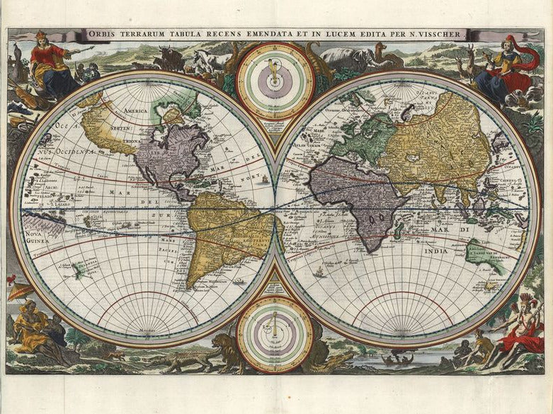
Orbis Terrarum Tabula Recens Emendata et in Lucem Edita
Daniel Stoopendaal
Veröffentlicht von Pieter und Jacob Keur, die Karte basiert auf Visschers Weltkarte von 1663. Umrandet von Tieren sowie den vier weiblichen Allegorien als Repräsentantinnen der Kontinente. Oben und unten zwischen den Hemispheren, stellen zwei Diagramme das Sonnensystem dar: die Theorien von Copernicus und Ptolemaios. Die Nordwest Küste von Nordamerika ist sehr genau dargestellt. Kalifornien ist als Insel eingezeichnet. West Australien und ein Teil von Neuseeland werden genauso gezeigt, wie die Inseln im Südpazifik.
altkolorierter Kupferstich
Bildmaß: 35,6 x 46,3 cm (Höhe x Breite)
This double hemispheric map is based on the World Map by Nicolas Visscher, originally printed in 1663. Surrounding this map are animals and four female representations of the continents. From the top left in a clockwise direction Europe, Asia, South America and Africa. Between the two main hemispheres are two opposing smaller maps showing conflicting theories of the solar system. The top is a Copernican heliocentric model with the Sun in the center; the bottom is a Ptolemaic system with Earth at the center. The northwest coast of North America is represented very accurately. California is shown as an island. Western Australia, Tasmania and part of New Zealand, are shown as islands in the South Pacific. Daniel Stoopendaal was a Dutch engraver who in 1680 published a world map "Orbis Terrarum" in a Dutch Bible. In addition to global maps, he also created maps of different European cities.
Handcoloured copperplate engraving
Size: 35,6 x 46,3 cm