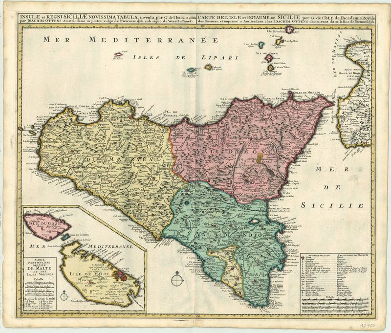
Beschreibung
Südeuropa / Italien / Sizilien
Ottens
ca. 1730
English |
Northern Greece, Albania and Macedonia. The map gives an accurate impression of the complicated political situation present in this period of history. Since the 15th century, Albania was in possession of the Republic of Venice located on the Adriatic coast of modern day Montenegro. Until 1797 this was an important outpost against the advance of the Ottoman Empire. Dalmatia from 1699 was also part of the Republic of Venice. The top right has a detailed uncolored title cartouche. The Republic of Ragusa was until 1808 a maritime city-state. The map details the boundaries that were created by the battle of Zenta in 1697. In this battle, Prince Eugene of Savoy, won a bloody victory over the Ottoman Empire. The boundaries were established in 1699 by the Peace of Karlowitz where the whole of Hungary was annexed to Austria. The bottom left has both a mileage scale and legend. The Homann Heirs (Homann Erben) was a company that continued the work of legendary cartographer Johann Baptist Homann (1664-1724) who was at one time geographer of the Holy Roman Empire. The Heirs were in business until from 1730 -1852. |
Deutsch |
Schöne detaillierte Ansicht von Sizilien und den Liparischen Inseln. Im Osten ist die Karte begrenzt durch das Gebiet um Neapel. Unten links ein Aufriß der Insel Malta und Gozo. Unten rechts eine Kartusche mit Erklärungen. Sizilien ist dreifarbig gestaltet und untergliedert in die Bereiche: Val de Mazzara, Val Demone und Val di Noto sowie das Comte di Modica. Oberhalb der Karte befindet sich der genaue Titel auf Latein, während die restlichen Beschriftungen auf Französisch oder auch Italienisch verfasst wurden. |