

Beschreibung
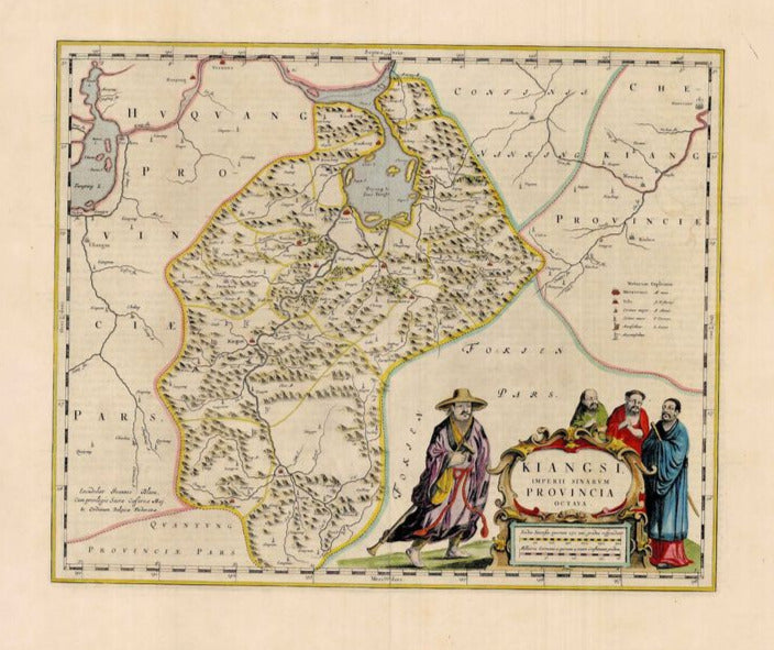
Kiangsi, Imperium Sinarum Provincia Octava
Joan Blaeu
Die südlich-zentral gelegene Provinz Jiangxi aus dem "Atlas Sinensis". Es ist die erste westliche Karte der Provinz, die nach detailgenauen Vorgaben des Jesuiten Martion Martini gefertigt wurde. Unten links eine sehr dekorative Kartusche mit vier Figuren. Blaeu schrieb in sein Tagebuch: "Pfarrer Martinus Martinus kommt aus Indien und bringt Beschreibungen und Zeichnungen aus dem chinesischen Reich mit. Er besteht darauf, dass ich eine Karte anfertige und sie veröffentliche. Dafür lasse ich alle anderen Arbeiten liegen, um mich ausschließlich dieser Arbeit widmen zu können."
handkolorierter Kupferstich
Bildmaß: 40 x 48,5 cm (Höhe x Breite)