

Beschreibung
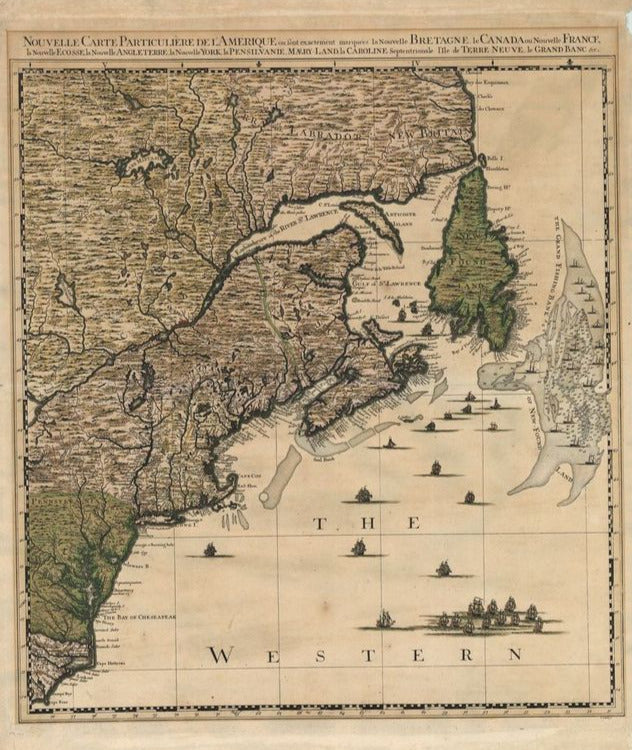
Nouvelle Carte Particuliere de l´Amerique ou sont exactement marquees la Nouvelle Bretagne, le Canada ou Nouvelle France, la Nouvelle Ecosse, la Nouvelle Angleterre, la Nouvelle York, la Pensilvanie, Maery-Land, la Caroline
Jean Covens & Pierre Mortier
Dies ist das nordöstliche Blatt aus Covens & Mortier's Ausgabe von Popple's eindrucksvoller Karte von Nordamerika. Die Grundlage für Popple's Karte bildeten Informationen aus erster Hand, die er über mehrere Jahre in der Behörde für Trade and Plantations gesammelt hatte. Die Karte, erstmals in London in zwanzig Blättern 1733 verlegt, war die erste britische Karte in großem Maßstab, die eine allgemeine Ansicht über die östliche Hälfte von Nordamerika lieferte. Als die Spannungen zwischen den Kolonialmächten wuchsen, wurde die Karte in ganz Europa immens einflußreich und von verschiedenen Kartographen kopiert.
Die Karte bildet die Region von Labrador bis Cape Fear ab, Nord Carolina, vom Inland bis zum östlichen Ufer des Lake Ontario. Die Karte zeigt unglaubliche Details, eingeschlossen der bedeutenden Grand Fishing Bank von Neufundland. Im Meer segeln unzählige, verschiedene Schiffe und Fischerboote. Die Karte steht mit ihren vollständigen Grenzen für sich allein. Über der Karte der Titel.
altkolorierter Kupferstich
Bildmaß: 52,3 x 59,8 cm (Höhe x Breite)