

Beschreibung
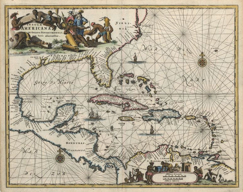
Insulae Americanae in Oceano Septentrionali, cum Terris adiacentibus
Arnoldus Montanus
Außergewöhnliche Karte von den West Indies, die zusätzlich die Ostküste Nordamerikas von Chesapeake bis zum Golf von Mexiko, Zentralamerika und Südamerikas Nordküste umfasst. Eine figürliche Kartusche füllt den Nordamerikanischen Kontinent und eine gleichwertige graphische Kartusche mit Meilenzeiger das innere Südamerikas aus, beide sind von europäischen Händlern und Eingeborenen umgeben. Die Meere sind mit Navigationslinien, Schiffen und Kompassrosen geschmückt.
Arnold Montanus veröffentlichte 1670-1671 einen bedeutenden Atlas von Amerika, den "Nieuwe en Onbekende Wereld". Er enthielt Karten von Virginia, Neuengland, Mittelamerika und der Karibik. Die Karten zeichneten sich durch ihre außerordentliche Gestaltung aus und boten einen Eindruck von New Amsterdam kurz nach der Gründung. Die Karten wurden bis 1761 von anderen Verlagen weiter verlegt.
handkolorierter Kupferstich
Bildmaß: 28,5 x 36,2 cm (Höhe x Breite)