Beschreibung
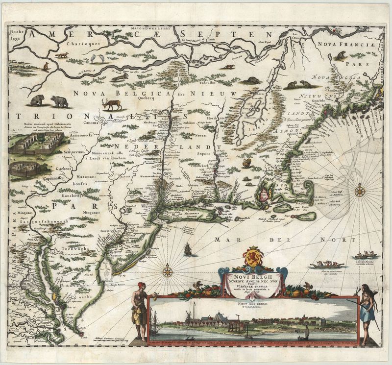
Novi Belgii Novaeque Angliae nec non partes Virginiae
Hugo Allardt
Diese äußerst seltene Karte des us-amerikanischen Ostküste geht zurück auf den Amsterdamer Verleger Hugo Allardt (1627–c. 1684). Bei dem vorliegenden Blatt handelt es sich um eine der ersten Darstellungen der niederländischen Besiedlung der Neuen Welt im 17. Jahrhundert.
Das Kartenbild erstreckt sich von Quebec im Norden bis zur Chesapeake Bay im Süden. Faszinierend sind die zahlreichen Details der Darstellung, denn sie zeigt nicht nur indigene Siedlungsformen und -gebiete, sondern auch zahlreiche Tiere, die jene Teile des Kartenbildes bedecken, der noch unbekanntes Terrain zeigt. Verbunden mit der Titelkartusche ist eine der ersten Darstellungen von „Neu Amsterdam“ bzw. New York – tatsächlich gibt es nur eine Darstellung, die älter ist (1651). Deshalb zählt die Karte zu den wichtigsten Darstellungen Nordamerikas überhaupt.
Das Kartenbild selbst hat eine äußerst komplizierte Veröffentlichungsgeschichte, da es gleich von mehreren berühmten Verlegern publiziert worden ist. Den Ausgangspunkt bildete eine Karte des Amsterdamer Kartografen Janssonius (1650). Danach folgten überarbeitete Versionen durch Nicholaes Visscher , Justus Danckerts (1655) und Hugo Allard. Insgesamt lassen sich fünf Auflagen unterscheiden: Die erste Auflage zeigt noch nicht „Fort Kasimer“ am Delaware (c. 1655); die zweite Version – die hier vorliegt – nennt „Fort Kasimer“(1656); die dritte Version zeigt zusätzlich Philadelphia (1684) und die vierte Version, ebenfalls von 1684, besitzt ein Privileg links der Stadtansicht; die fünfte Version nennt als Autor Petrus Schenk (c. 1729).
handkolorierter Kupferstich
Bildmaß: 46,4 x 54,1 cm (Höhe x Breite)

