

Beschreibung
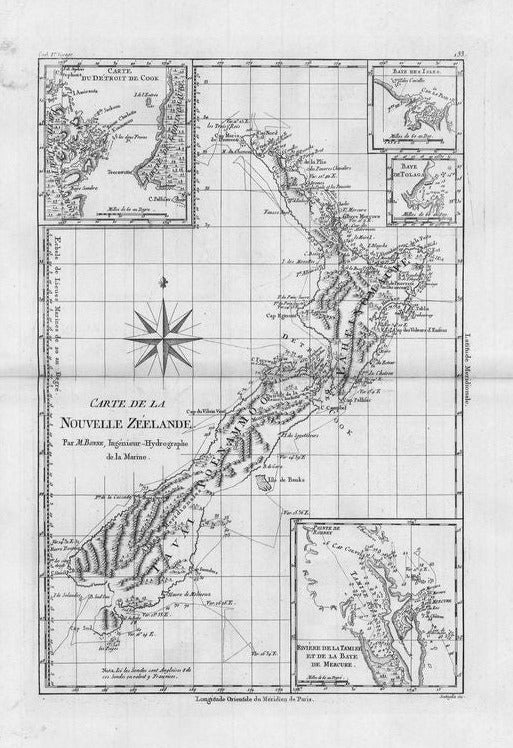
Carte de la Nouvelle Zeelande
Rigobert Bonne
Seltene detaillierte Karte von Neuseeland, die die Route von Kapitän Cooks erster Reise zeigt. Die Karte ist sorgfältig graviert. Sie enthält vier kleinere Karten der Coromandel Peninsula (hier Mercure Bayund Tamise River genannt), der Cook Strait, der Bay of Islands und der Tolaga Bay.
unkolorierter Kupferstich
Bildmaß: 34,3 x 22,9 cm (Höhe x Breite)