

Beschreibung
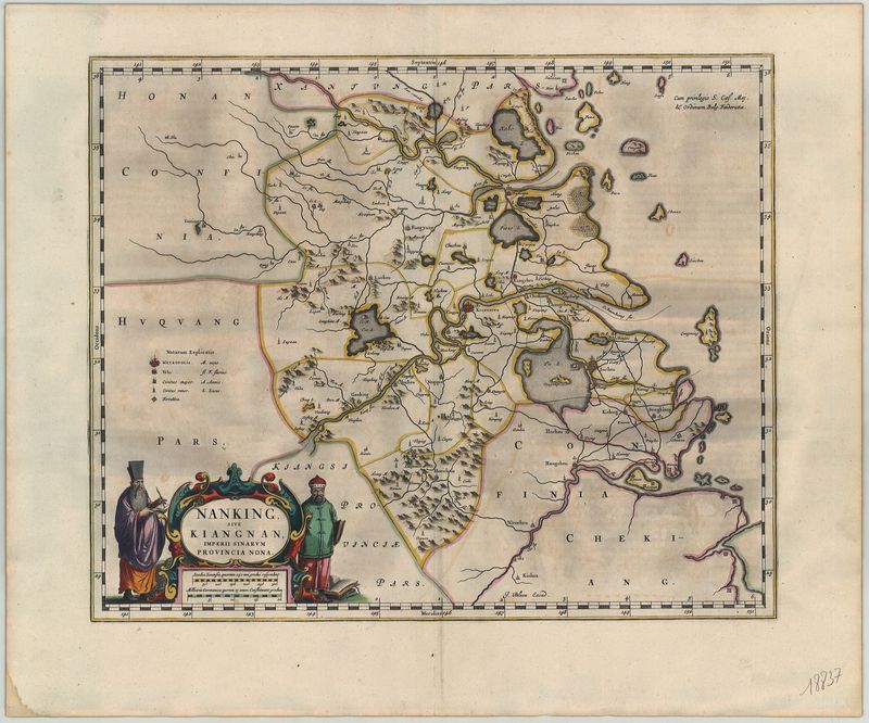
Nanking, sive Kiangnan, Imperii Sinarum Provincia Nona
Joan Blaeu
Diese sehr seltene Karte von der Ostchinesischen Küste geht zurück auf den berühmten Kartografen Joan Blaeu (1596–1673). Ursprünglich war das Blatt Teil des „Atlas Maior“, einem der aufwendigsten Buchprojekte seiner Zeit.
Das Kartenbild fokussiert sich auf die heutige Provinz Nanjing im Osten Chinas. An der Küste ist jene Region zu erkennen, auf der das moderne Schanghai entstehen wird (die Stadt „Xhanhai“ ist bereits zu erkennen).
Für seine Karte griff der Amsterdamer Verleger Blaeu auf Entwürfe des Italieners Martino Martini (1614–1661) zurück. Martini lebte als Jesuit mehrere Jahre in China und fertigte dort Karten nach einheimischen Vorlagen an. Er war tatsächlich so bekannt, dass er sogar einer chinesischen Delegation vorstand, die nach Europa reiste. Martini wurde allerdings dabei von holländischen Truppen festgenommen und nach Amsterdam verschifft (1654). Nachdem er dort einen chinesischen Atlas ins Lateinische übertragen hatte, wurden Martinis Karten benutzt, um den ersten europäischen Atlas von China zu drucken („Novus Atlas Sinensis“, 1655). Die einzelnen Karten wurden später noch in mehreren anderen Atlanten der Offizin Blaeu abgedruckt.
handkolorierter Kupferstich
Bildmaß: 40,5 x 49 cm (Höhe x Breite)