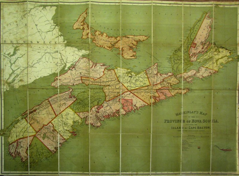
3129 Mackinlay, A. : Mackinlay´s Map of the Province of Nova Scotia, Including the Island of Cape Breton. 1865

vendor-unknownSKU: 3129
Keine Bewertungen

Preis:
Sonderpreis$530.00

inkl. MwSt. Versandkosten werden im Checkout berechnet.

Lagerbestand:
Auf Lager

Beschreibung

America / Canada
Amerika / Kanada
Mackinlay, A.
ca. 1865

English
Canada

Mackinlay, A.
ca. 1865
copperplate engraving
ORIGINAL

A & W Mackinlay were publishers of Halifax Nova Scotia and Prince Edward Island is who published several maps of the region between 1859-1884.

Tooley's Dictionary of Mapmaker, Early World Press, 2004, p180


Deutsch
Kanada

Mackinlay, A.
ca. 1865
Kupferstich
ORIGINALKARTE

Diese sehr große Karte zeigt neben Nova Scotia und Cape Breton Island auch Prince Edeward Island, Sable Island und einen Teil von Brunswick. Sie enthält Straßen, Telegraphen-Verbindungen, Eisenbahnlinien, Grenzen und manches mehr. Die Karte ist farbig gedruckt und in 32 Teile auf Leinen zum Falten zerlegt. Sie ist in Halifax erschienen.


Das könnte Sie auch interessieren

Zuletzt angesehen