Kanada im Jahr 1778 von Antonio Zatta

ReproduktionSKU: R 3130
Keine Bewertungen

Preis:
Sonderpreis€46,90

inkl. MwSt. Versandkosten werden im Checkout berechnet.

Lagerbestand:
Auf Lager

Beschreibung

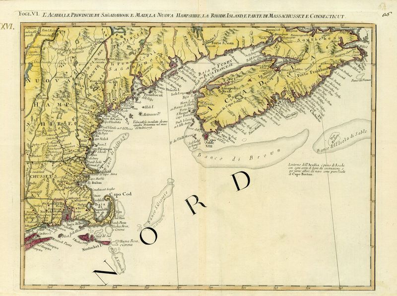
L´Acadia, le Provincie di Sagadahook e Main, la Nuova Hampshire, la Rhode Island, e Parte di Massachusset e Connecticut
Antonio Zatta

Die Karte ist ein Blatt der 12teiligen Karte von Zatta, die unter dem Titel "Le Colone Unite dell´America Settenrie" herausgegeben wurde.

kolorierter Kupferstich
Bildmaß: 33 x 43 cm (Höhe x Breite)


Published in Zatta's Atlante Novissimo between 1779-1785. Based on a eariler map of the region by from Mitchell's Map of North America. Antonio Zattas published maps from 1750 and was one of the largest publishers and distributors of illustrated books in 18th century Italy based in Venice. His most outstanding achievement was the atlas "Atlante Novissimo" printed between 1776-1785 which contained over 240 maps.

copperplate engraving

Das könnte Sie auch interessieren

Zuletzt angesehen