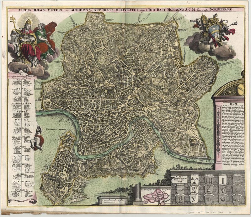
Beschreibung
Südeuropa / Italien / Rom
Homann, Johann Baptist
ca. 1730
English |
A very detailed and attractive map of the city of Rome with a secondary map showing the Seven Hills of Rome, one of the best of the period. Streets, plazas, bridges, statues and other features are shown in extreme detail. The two colored cartouches show the most important churches and squares, as well as aspects of the city's history. The top left figure holds the key to the 14 different districts, whose coat of arms in the cartouche on the bottom right. Johann Baptist Homann (1664-1724) was the cartograher of The Holy Roman Empire from 1715 and a member of the Prussian Royal Academy of Sciences. His work would be continued after his death by a company called The Homman Heirs. |
Deutsch |
Sehr detailierter Plan der Stadt Rom mit einer Nebenkarte, auf der die sieben Hügel Roms abgebildet sind. Die beiden kolorierten Kartuschen nennen die wichtigsten Kirchen und Plätze, sowie die Stadtgeschichte. Die Figur links oben hält den Schlüssel zu den 14 verschiedenen Stadtteilen, deren Wappen in der Kartusche rechts unten abgebildet sind. |