

Beschreibung
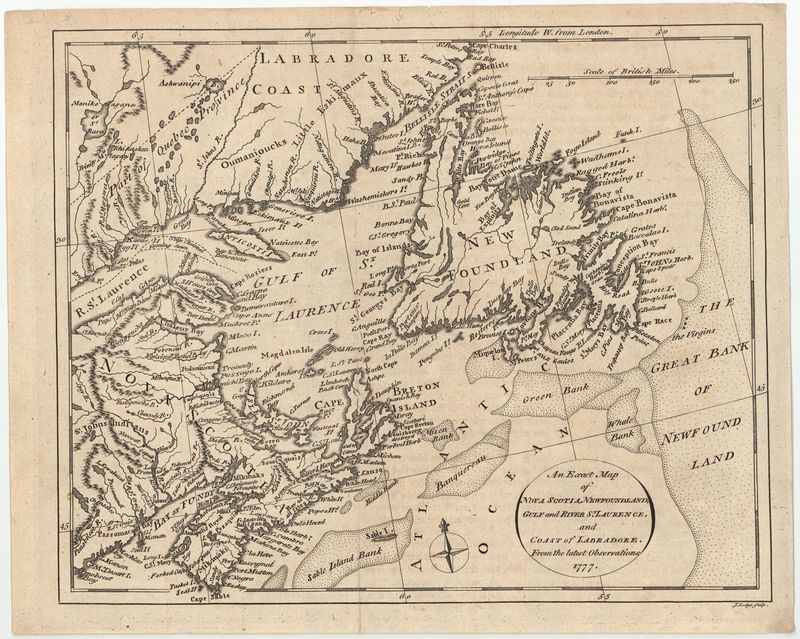
An Exact Map of Nova Scotia, Newfoundland, Gulf and River St. Laurence, and Coast of Labrador, from the latest Observations
William Russel
Sehr exakte und detaillierte Karte von Neufundland, Nova Scotia und der Küste von Labrador. Das Kartenbild basiert auf Expeditionen des Jahres 1777 – es dokumentiert sogar die den Küsten vorgelagerten Untiefen. Ursprünglich war das Blatt Teil des Buches „The History of America, from its discovery by Columbus to the Conclusion of the Late war“ (Band 2, Seite 245). Der Autor der Abhandlung war der Brite William Russell.
unkolorierter Kupferstich
Bildmaß: 21,1 x 25,4 cm (Höhe x Breite)