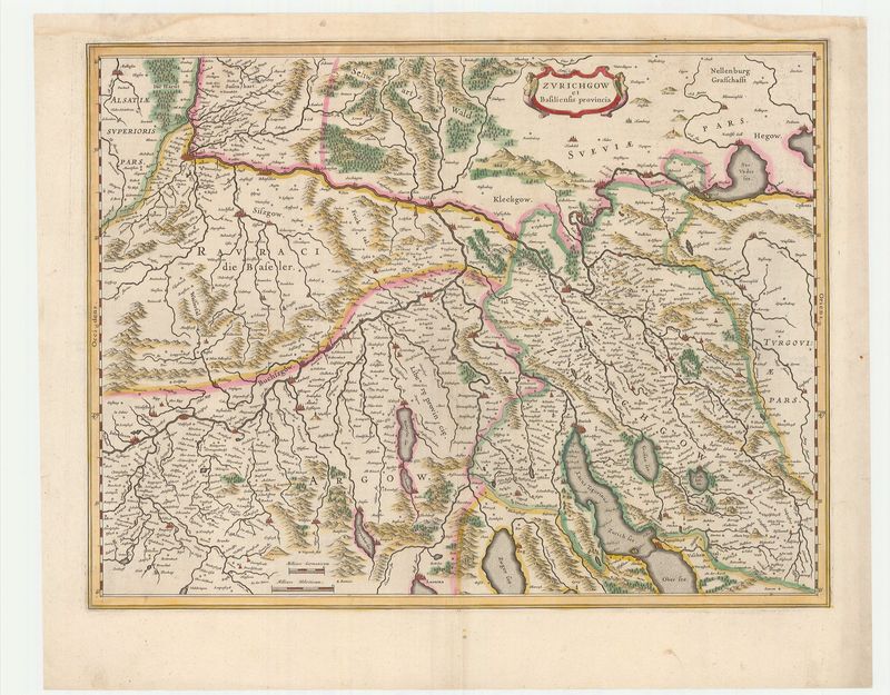
3231 Blaeu, Willem und Joan: Zurichgow et Basiliensis 1635

vendor-unknownSKU: 3231
Keine Bewertungen

Preis:
Sonderpreis$528.00

inkl. MwSt. Versandkosten werden im Checkout berechnet.

Lagerbestand:
Auf Lager

Beschreibung

Alpine region / Switzerland
Alpenländer / Schweiz
Blaeu
1635

English
Switzerland

Blaeu
1635
copperplate engraving
50 x 38,2 cm
ORIGINAL


The Zürich ‘gau’ (province) of Basel bordered by Alsace, The Black Forest, Swabian and the cantons of Aargau, Lucerne and Thurgau in Switzerland. In the north is part of Lake Constance. The top center has a simple title cartouche. Ornaments have generally been waived in favor of a very detailed and accurate representation of geography. Major cities such as Zurich along with rivers are shown with bridges. Willem Janszoon Blaeu (1571-1638) he founded his own cartography business which was continued by his sons, Joan (1597/98-1673) and Cornelis (c. 1610-1642). He would become one of the most famous and internationally renown map and atlas publishers and contributed to the 17 Century Dutch cartography for the "Golden Age”.

References
Europae Celeberrimum Totius Dantiscum Emporium, Niewocniczanski, 2004/2005
Tooley's Dictionary of Mapmaker, Early World Press, 2004, p143-145


Deutsch
Schweiz

Blaeu
1635
Kupferstich
50 x 38,2 cm
ORIGINALKARTE

Die Karte zeigt das Zürichgau und den Kanton Basel, begrenzt durch Elsass, Schwarzwald und Schwaben, sowie die Kantone Aargau, Luzern und Thurgau. Im Norden ist der Untersee, ein Ausläufer des Bodensees zu sehen. Die schlichte Titelkartusche ist mit Gallionsfiguren verziert. Auf weiteres Ornament wurde verzichtet, zu Gunsten einer sehr detaillierten und exakten Darstellung der Geographie. Größere Städte an Flüssen, wie Zürich, sind sogar mit Brücken versehen.


Das könnte Sie auch interessieren

Zuletzt angesehen