

Beschreibung
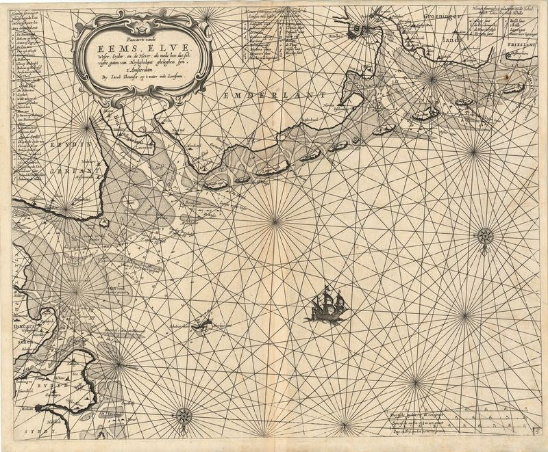
Pascaerte vande Eems, Elve, Weser, Eyder, en de Hever: als mede hoe dieselvighe gaten van Heylighelant gheleghen syn
Jacob & Caspar Lootsman
Diese fantastisch detaillierte Seekarte zeigt die Mündungsgebiete von Ems, Elbe, Weser und Eider sowie den Verlauf des Heverstroms im nordfriesischen Wattenmeer. Die Autoren des Blattes waren die Amsterdamer Kartografen Caspar und Jacon Lootsman, die wiederum auf einen Entwurf ihrer Vaters Abthonie Jacobsz zurückgriffen.
Das Kartenbild gibt nicht nur den deutlich konturierten Küstenverlauf wieder, sondern verzeichnet auch Wassertiefen und Wattgebiete – für Navigation auf See waren dies geradezu lebenswichtige Informationen. Dem praktischen Gebrauch sollten auch die drei ergänzenden Legenden dienen: Sie erläutern Seezeichen und markante Navigationspunkte.
unkolorierter Kupferstich
Bildmaß: 45,2 x 54,7 cm (Höhe x Breite)