

Beschreibung
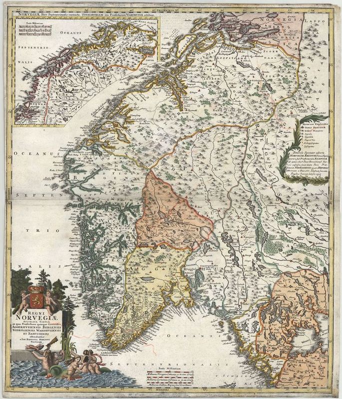
Regni Norvegiae Accurata Tabula in qua Praefecturae quinque Generales
Johann Baptist Homann
Prachtvolle Karte vom Königreich Norwegen in seiner Ausdehnung zwischen Göteborg und dem Nordmeer. Die Herrschaft ist unterteilt in Amtsbereiche. Die Kartusche am rechten Rand enthält eine "notarum explicatio" - eine Legende - sowie eine kurze politische Erklärung für einige Präfekturbereiche, die in Form einer Ansprache an den Betrachter verfasst ist. Darin werden der Frieden von Roskilde 1658 und der Frieden von Kopenhagen 1660 erwähnt. Diese beendeten den Krieg zwischen Dänemark-Norwegen (zwischen 1380 und 1813 Personalunion unter dänischer Vorherrschaft) und Schweden. Dänemark musste seine Besitzungen im heutigen Südschweden aufgeben.
Oben links eine Insetkarte der beiden nördlichsten norwegischen Präfekturen von Vardo und Trondheim. Der gefährliche Malstrom ist vermerkt. Unten mittig ein Meilenzeiger. Unten links die kunstvoll gestaltete Titelkartusche mit figürlicher Staffage. Der Titel ist gekrönt durch das norwegische Königswappen. Zahlreiche Putten und Meerjungfrauen bilden eine maritime Naturszene. Als Vorlage für diese Karte diente eine Arbeit von Frederick de Wit. Bemerkenswert ist die Präzision mit der Fjorde und Küstenregionen gezeichnet sind.
altkolorierter Kupferstich
Bildmaß: 49,7 x 58,3 cm (Höhe x Breite)