


Beschreibung
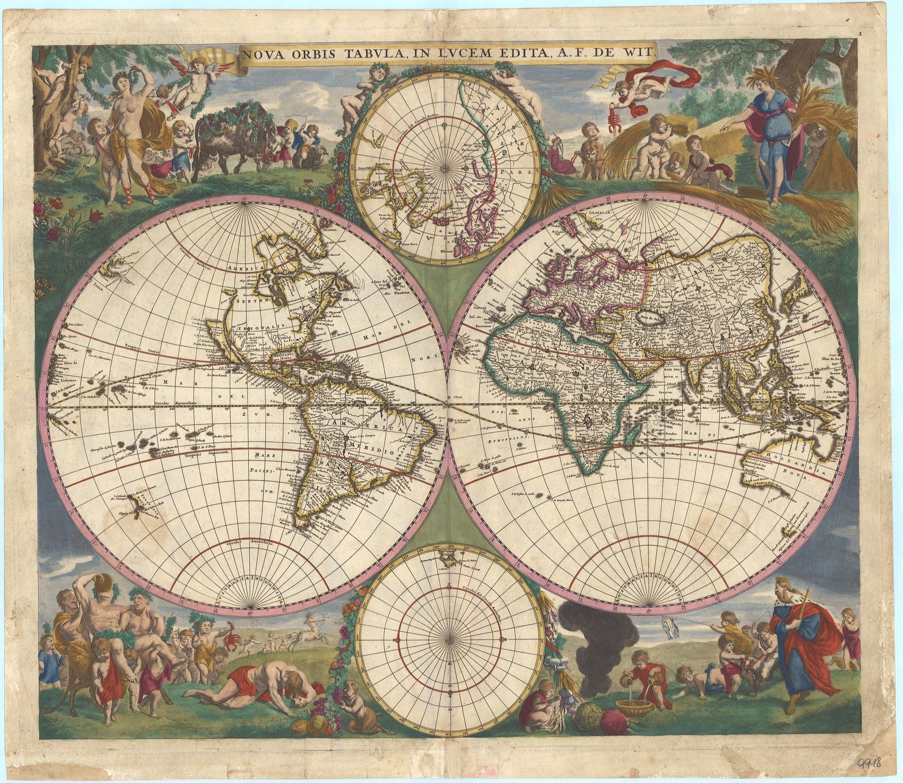
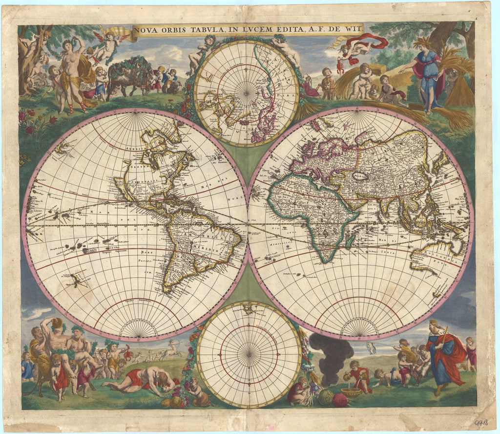
Nova Orbis Tabula etc.
Frederik de Wit
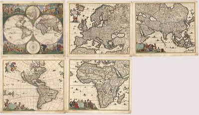
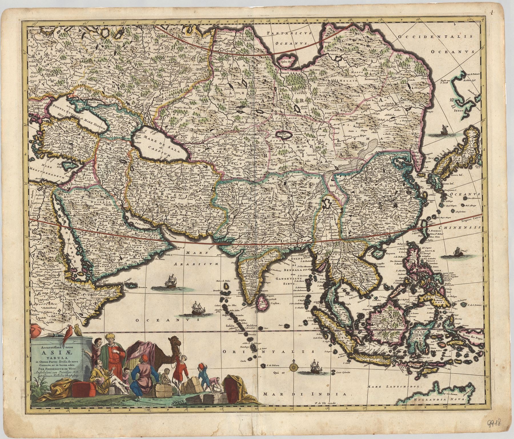
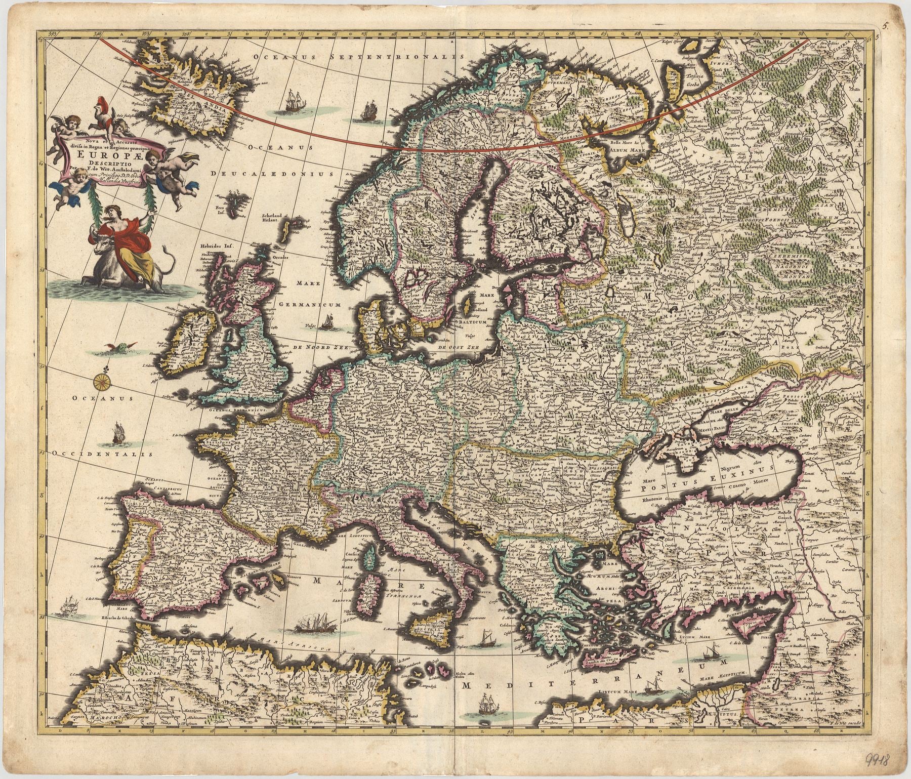
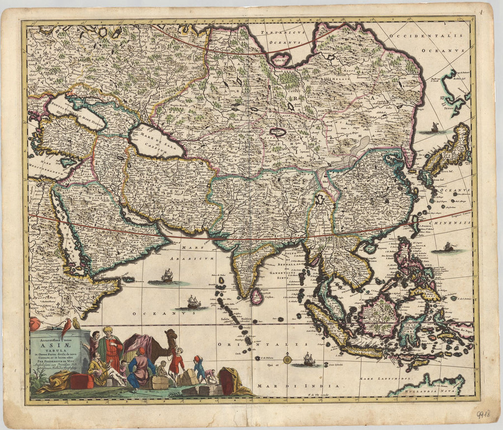
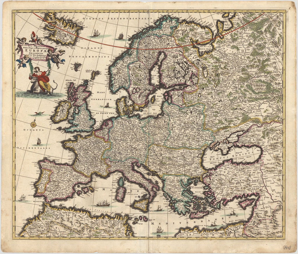
Dieses faszinierende Set aus fünf Einzelkarten geht zurück auf den berühmten niederländischen Verleger Frederik de Wit (1610–1706). Ursprünglich waren die Blätter Teil eines Atlasses aus dem Verlag de Wit. Zusammen bilden die Blätter eines der schönsten und gefragtesten Kartensets der Frühen Neuzeit.
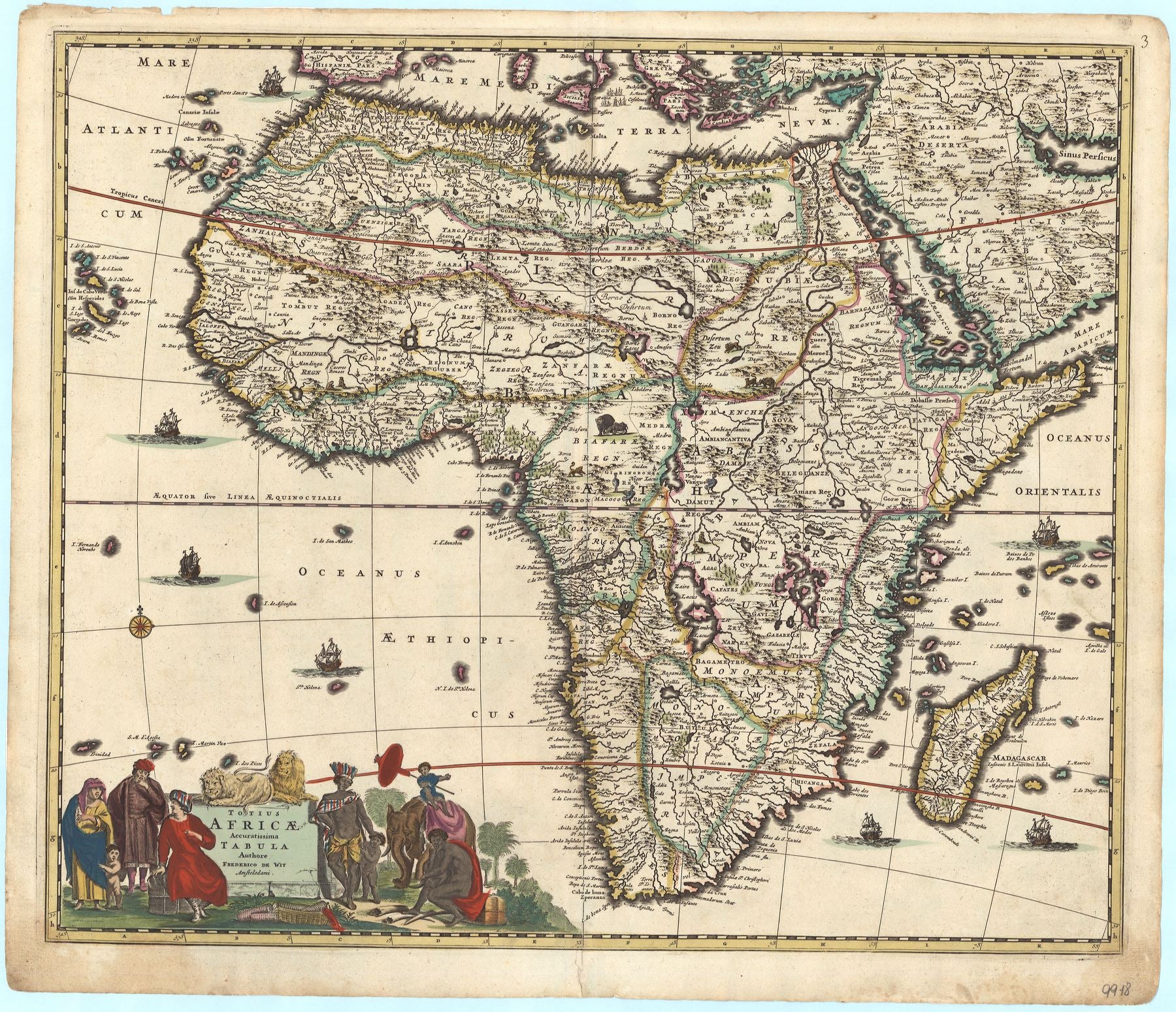
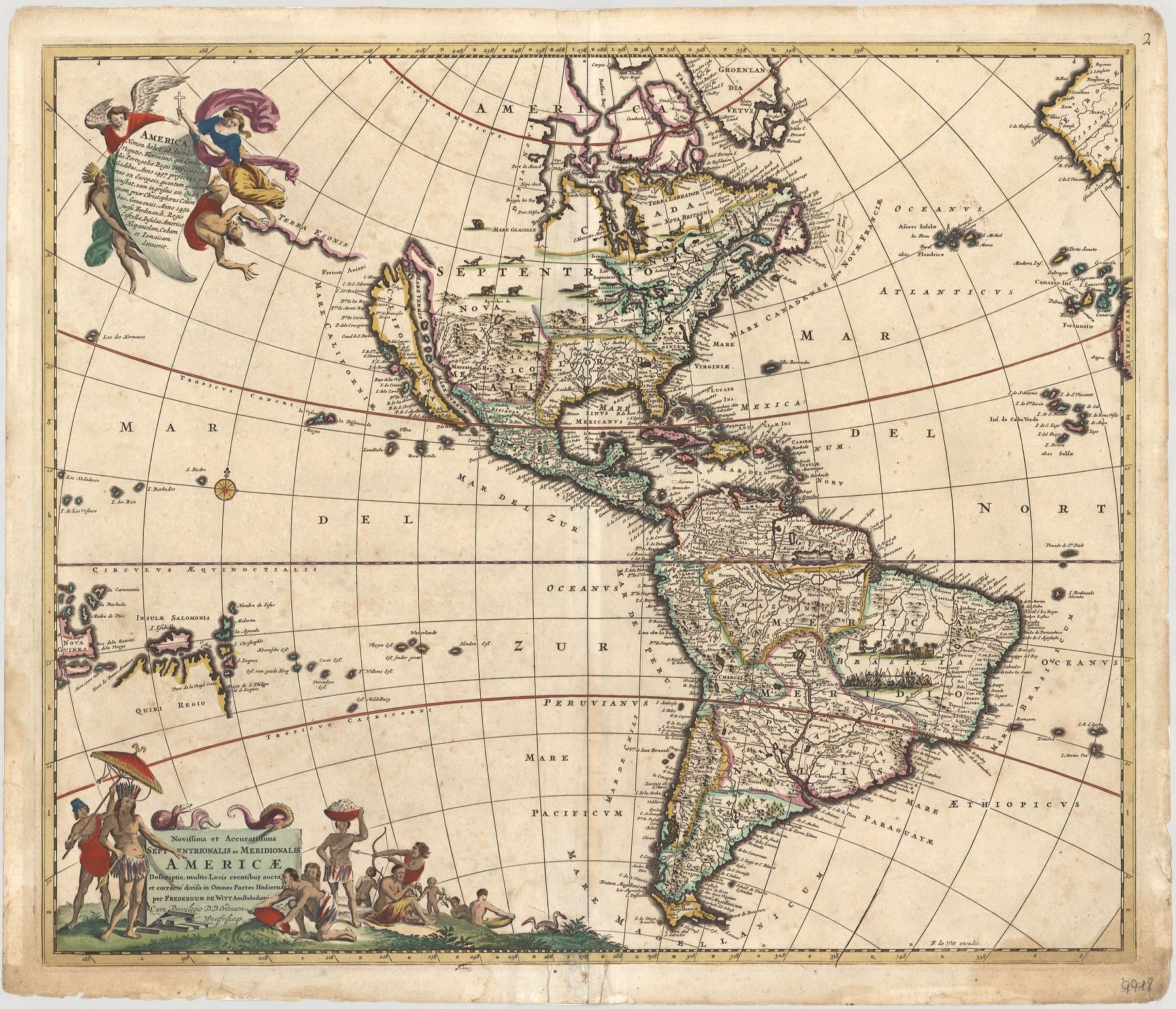
Die fünf Blätter zeigen die vier seinerzeit bekannten Kontinente mit einer Weltkarte in zwei Hemisphären. Auffällig ist, dass sich die Topografien einzelner Regionen unterscheiden, je nachdem, ob man auf die Weltkarte oder die Kontinentalkarten schaut. So zeigt etwa das Blatt von Amerika einen ausdefinierteren Bereich im Norden und eine viel detaillierte Binnenkartierung im Süden – wobei natürlich viele Informationen auf legendarischen Reiseberichten beruhen. Staunenswert ist auch die minutiöse Kartierung von Afrika, das de facto noch kaum bereist worden war.
Exemplarisch für die herausragende Bedeutung des Kartensets ist die Weltkarte, denn sie zählt heute zu den dekorativsten Weltkarten überhaupt. Die Doppelhemisphäre repräsentiert das geografische Wissen ihrer Zeit: Zwar sind Australien und Neuseeland angezeichnet, das volle Ausmaß der Landmassen ist aber noch kaum zu erahnen. Große Teile von Nordamerika sind noch nicht erschlossen und Kalifornien wird als Insel dargestellt. Ebenfalls schemenhaft sind die asiatischen Inselwelten um Japan und die Philippinen. Zwischen den Hemisphären sind der Nord- und Südpol dargestellt. Die Zwickelfelder zeigen zauberhaft e Szenen der antiken Mythologie, in denen aber auch die vier Jahreszeiten, die Sternzeichen und die Elemente versteckt sind – ein wundervoll mehdeutiges Bildensemble, das sich auf der absoluten Höhe der barocken Kunst bewegt. Wahrscheinlich wurde de Weltkarte bereits um 1660 entworfen, was die topografischen Unterschiede zu den Kontinentaldarstellungen erklären würde.
Typisch für die Arbeit von de Wit sind neben der herausragenden Detailiertheit der Kartenbilder ihre vielfigurigen Kartuschen, die auch auf die wachsenden Handelsbeziehungen hinweisen, welche die Niederlande im 17. Jahrhundert zu einer der wichtigsten und wohlhabendsten Regionen in Europa werden ließ. Paradigmatisch hierfür sind die Gründungen der Indien-Kompanien (1602 bzw. 1621).
fünf altkolorierte Kupferstiche
Bildmaß: je 48,8 x 57,6 cm (Höhe x Breite)