

Beschreibung
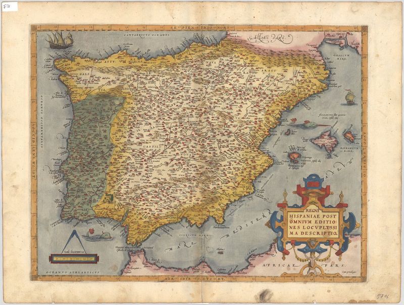
Regni Hispaniae Post Omnium Editiones Locuplessima Descpritio.
Abraham Ortelius
Diese exzellent erhaltene und äußerst kunstvoll gezeichnete Karte zeigt die Königreiche von Spanien und Portugal. Erschienen ist das exzellent erhaltene Blatt im Jahr 1573 – drei Jahre, bevor das Gebiet unter die Herrschaft der Habsburger geriet. Der Autor der Karte war der berühmte Verleger Abraham Ortelius (1527–1598).
Als Vorlage für sein äußerst dekoratives Blatt benutzte Ortelius eine Karte des flämischen Gelehrten Charles de l'Écluse, „Carolus Clusius“ (1526–1609). Clusius hatte Spanien bereist und im Jahr 1571 eine große Karte aus sechs Einzelblättern veröffentlicht.
Fantastisch an Ortelius’ Karte ist ihre immense Liebe zum Detail. Es lassen sich zahllose Ortschaften identifizieren, und das Meer wird von den typischen Seeungeheuern durchkreuzt. Ebenso markant ist die hervorragend gestaltete Kartusche, deren Formen aus der Fläche herauszuragen scheinen.
altkolorierter Kupferstich
Bildmaß: 38 x 49,5 cm (Höhe x Breite)