


Beschreibung
Japan Railway & Road Travel Atlas
Tokyo, Osaka, Kobe, Nara, Sapporo
Kartoniert, V, 119 Seiten,
Maße: (LxBxH): 20,8x,9x,8 cm, Gewicht: 164 g
Verlag/Hersteller: International Travel Maps
Auflage: 3. Auflage
Erscheinungsdatum: 23.07.2025
Sprache(n): Englisch
Landkarte / Straßenkarte von Japan
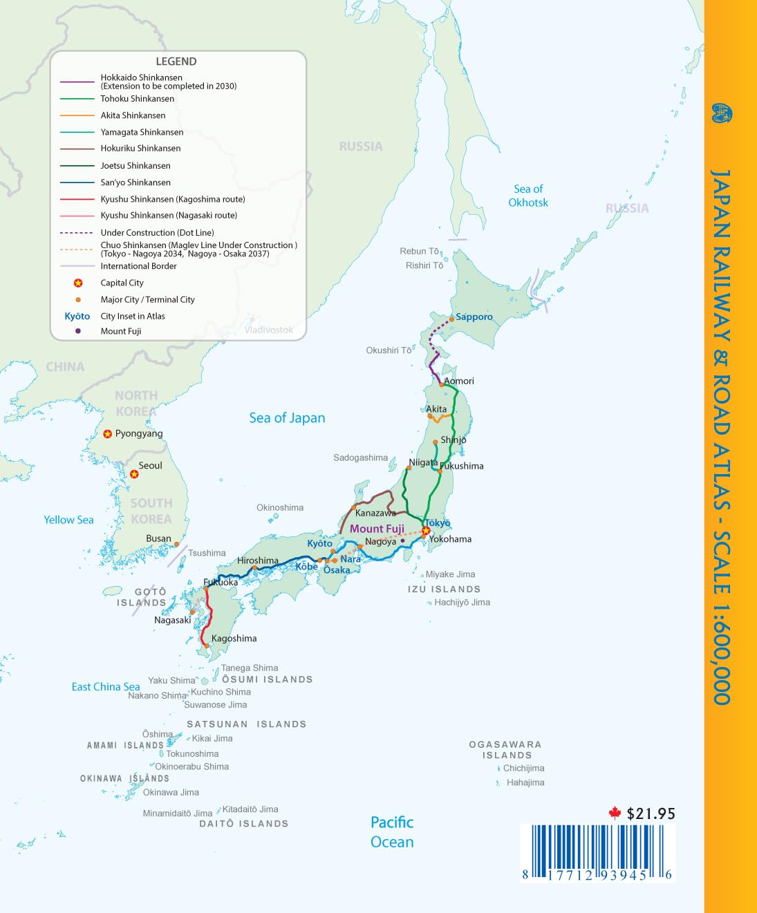
This new book atlas is a complete revision of our previous atlas. It is perfect bound as opposed to stapled and sits on display shelves much better. At larger size than previous version 9x7.5`, the scale is so good that the country can be shown to advantage at a much better scale than via a folded paper map. The vast majority of visitors to Japan travel around the country by using the country’s excellent rail network. Japan currently has a two-layer rail system - long-distance fast trains, called Shinkensen, and slower local trains serving all stops along a rail line. A third system, using Maglev technology, is under construction, but will not be available for several years. Japan has invested heavily in its rail network, including providing rail passes for visitors that make it easy for visitors to travel by train around the country. In the atlas, the fast trains are shown in red and the regular trains in blue. All major highways are shown as well. By expanding the scale, place names are easy to read, and points of interest easy to locate. Pages of urban maps are included, including transit maps for Tokyo, Kyoto, Nara, Osaka, and Sapporo.