Beschreibung
British Antarctic Survey - Antarktis - Anarktische Halbinsel
Scale: 1:250.000
Size: 75 x 89 cm, folded
Language: english
Published: 2017
Description:
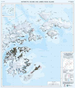
This double-sided map provides an overview of the northern part of the Antarctic Peninsula. It covers the area between Joinville Island and Hughes Bay, including James Ross and Snow Hill islands and the northern limit of the Larsen Ice Shelf on the east coast. It connects to map BAS/UKAHT 2 to give full coverage of the northern Antarctic Peninsula as far south as Adelaide Island.
The two maps show topographic detail with a Landsat 8 satellite image mosaic backdrop. The maps include: Coastline; elevation information as contours and selected mountain summit heights; UK place-names; scientific research stations; Historic Sites and Monuments (HSMs) and Antarctic Specially Protected Areas (ASPAs).


