


Beschreibung
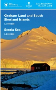
British Antarctic Survey No 1
Scale: 1: 1 000 000 and 1: 4 000 000
Edition: 7
Published: 2017
Size: 84 x 90 cm
Size Folded: 22.5 x 13.5 cm
Language: english
Stichworte: Antarktis, antarktische Halbinsel, Südshetland-Inseln, südliche Shetlandinseln, Elephant Island, King George Island, König-Georg-Insel, Deception Island, Bransfieldstraße, Livingston Island, Drake Passage
Description:
This double-sided map provides an overview of the northern Antarctic Peninsula area on side A, with a regional-scale map covering the Scotia Sea region on side B. It is an ideal companion for a voyage from South America or the Falkland Islands to South Georgia or the Antarctic Peninsula.
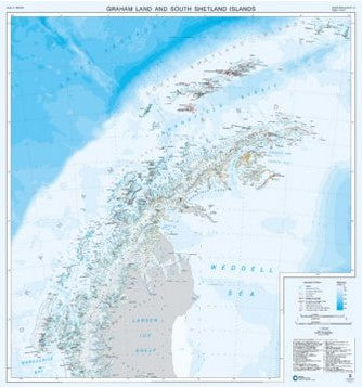
Side A: 1: 1 000 000 scale. This map covers the South Shetland Islands and the Antarctic Peninsula as far south as Marguerite Bay at 68°30′S. It shows topographic features such as: Coastline; ice shelves; rock exposure; contours; selected mountain summit heights; hill-shaded terrain; bathymetry, and major place-names; permanent and summer-only Scientific Research Stations and Historic Sites and Monuments.
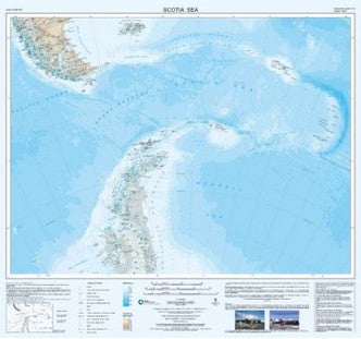
Side B: 1: 4 000 000 scale. This map covers the Scotia Sea region including: Argentina and Chile south of 50°S (including Ushuaia and Punta Arenas); the Falkland Islands; South Georgia; South Sandwich Islands; South Orkney Islands and the northern Antarctic Peninsula.
The map is printed on water-resistant paper and the folded version comes in a card cover.